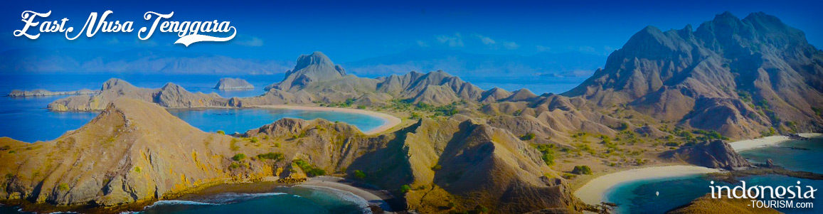
An Insight into East Nusa Tenggara Province, Indonesia
Indonesia consists of numerous provinces and all of them are unique. Located in the east part of the nation, East Nusa Tenggara Province has become one of the best vacation destinations especially for those who look for mesmerizing natural attractions and unique local traditions. The name of the capital is Kupang City and it even features an international airport! No wonder, the province is quite famous among foreign tourists as well. The next interesting feature of the region is the presence of famous woven fabric for tourists to buy when visiting the region.
The Nuance
East Nusa Tenggara Province consists of hundreds of island, which are about 550 of them! However, most tourists only recognize three major islands called Flores, Sumba, and Timor. No wonder, people also give another name to the region which is Flobamora (the combination of Flores, Sumba, and Timor). Due to the high number of islands, tourists may find various traditions and natural attractions there. As if they have unlimited places to explore during holidays! Have no worries. The region offers an excellent transportation service to tourists including boats, planes, etc. That means it would be easy to explore and get around the region regardless of the destination.
Exploring East Nusa Tenggara Province
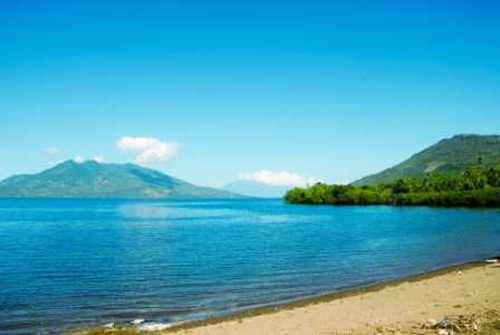
The first recognizable potential of East Nusa Tenggara Province is definitely its natural beauty. Many natural attractions are available for tourists to explore especially the beaches! That means tourists can spend beautiful holidays in those places either with friends or families. Moreover, the options are just too many so it takes much time to explore those all. Not only they can enjoy beach walking, they are able to do other fun things like snorkeling, exploration, and photography.
What is next? East Nusa Tenggara Province is also famous for its unique culture. That means tourists can see numerous locals’ traditions including dances and houses. As for the houses, the most popular one perhaps is Saoata Musalakitana. It is used by important people of the region like the leader of the village, actually. Aside from the traditional house, tourists should find out about the traditional clothes of the locals with their unique ornaments and color! What about the dances? Three famous traditional dances are available for tourists to watch including Perang, Gareng Lameng, and Lendo Nusa Malole Dance.
During a visit in East Nusa Tenggara Province, it would be a waste if tourists do not try delicious local foods like Kolo, Catemak, Bose, Se’I, spicy anchovies, and many others. The good thing is that those foods are quite affordable and easy to find!
Famous Tourist Attractions
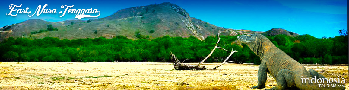
- Komodo National Park
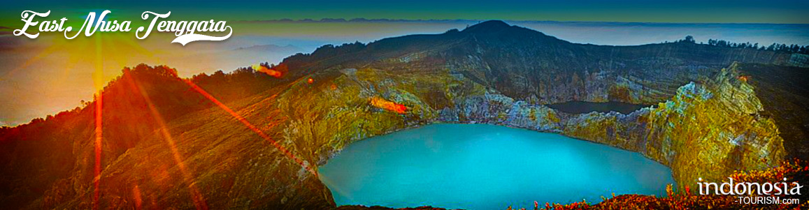
- Kelimutu National Park
- Pink Beach
- Loh Liang
- Lasiana Beach
- Kelimutu Lake
- Wae Rebo Village
- Batu Cermin Cave
- Tarung Village
- Sirung Mountain
How to Get There
From the capital of Indonesia (Jakarta City), tourists can take an airplane from Soekarno – Hatta International Airport to El Tari Airport of Kupang City. This flight takes approximately 2 hours and 55 minutes, actually. Once arriving at East Nusa Tenggara Province, they can start exploring the region using any available transportation services.
Where to Stay
- Cendana Hotel
- Pelita Hati Hotel
- Carvita Hotel
- Greenia Hotel
- Jolly Hotel
- Cahaya Bapa Hotel

Planning Your Wonderful Trip to Labuan Bajo And Komodo Island
Indonesia has thousands hundreds of islands. That is a very amazing fact because Indonesia is indeed an archipelagic country. Several islands in Indonesia are uninhabited but are still frequently visited by many tourists. This is because all the islands in Indonesia have their charm, have beautiful beaches, and are unique in their own right. Of all the islands owned, the only island inhabited by ancient animals is the Komodo dragon which can be visited by tourists. If you are looking for an all-in-one adventure experience, see Komodo dragons in their…
The Uniqueness of Koja Doi Tourism Village in East Nusa Tenggara
Koja Doi Village is located in East Alok sub-district, Sikka Regency, East Nusa Tenggara (NTT). Visitors can access this village by boat with a travel time of about 40 minutes from Nangahale Harbor. Koja Doi is one of the tourist villages that won the Indonesia Sustainable Tourism Award (ISTA) from the Ministry of Tourism and Creative Economy. This village offers marine tourism, nature tourism, and cultural tourism. Koja Doi Village has several spot to visit, such as the site of the 1992 tsunami, a stone bridge, ancient rock hills, and…
Enjoying the Enchantment of Marosi Beach in West Sumba
West Sumba has a number of beaches that are destinations and attractions for its tourism sector. One of them is Marosi Beach. This beach is located in Lamboya District. You don’t need long from Waikabubak to the location. Enough to travel overland for approximately one hour. In fact, you are also not charged a levy when entering this beach area. Marosi Beach is a beach that is completely empty of visitors. This is a recommended place for those of you who want to get rid of boredom from tired activities.…
Exploring Aili Beach in Central Sumba
Aili Beach in Central Sumba Regency, East Nusa Tenggara Province No one can deny the values of natural attractions like beaches, no? When it is about beautiful beaches, East Nusa Tenggara Province has many of them including the one called Aili Beach of Central Sumba Regency. To be exact, the location is in Konda Maloba Village and it resides in South Katikutana Sub-District. Like other beaches of NTT Province, this one is recognized for its pristine nuance and beautiful white sand. The good thing is that it resides in the…