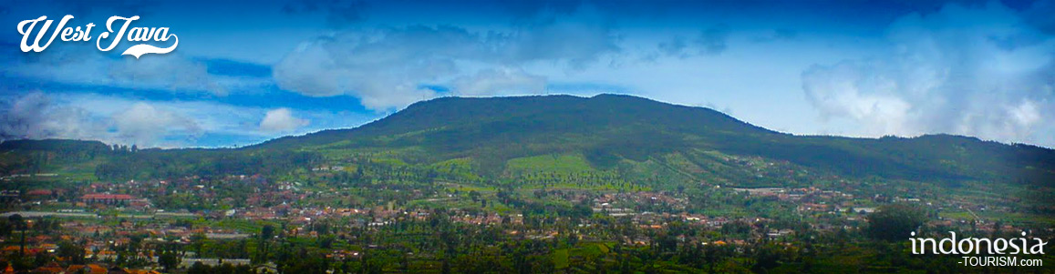
Mount Tangkuban Perahu
Tangkuban perahu is a volcano, 25 kilometers north of Bandung direction of Lembang. Its location is in between Sagalaherang village, Sagalaherang district, Subang regency and Cikole village, Lembang district, Bandung regency. This is Bandung's most famous tourist volcano just 28 km north of the city. This volcano offers many places to see and explore. Whether we look into the huge crater or hike down into it, stroll through the forest on its slopes, or simply enjoy the splendid panoramic scenery. Mt. Tangkuban Perahu is an interesting destination that everyone in the Bandung area is fond of visiting. When seen from Bandung, Mt. Tangkuban Perahu has a distinctive shape, like an upside down boat. Tangkuban Perahu means, in fact, "up-turned boat" This peculiar shape has stimulated the fantasy of the Sundanese people from early times as expressed in the Legend of Sangkuriang. Geologically, Mt. Tangkuban Perahu has played a significant role in the development of Parahyangan highlands. Eruptions have contributed immensely to the hills north of Bandung through lava flowing into the valleys and hardening into rock, thus forming big cliffs over which waterfalls leap. Likewise, mud flows have formed a semi-circular cone of gentle gradient (what geologists call "a fan"), which is now a mass that blocked the valley of the ancient Citarum River near present day in Padalarang (some 18 km west of Bandung), this caused a lake to form covering the whole Bandung plain.
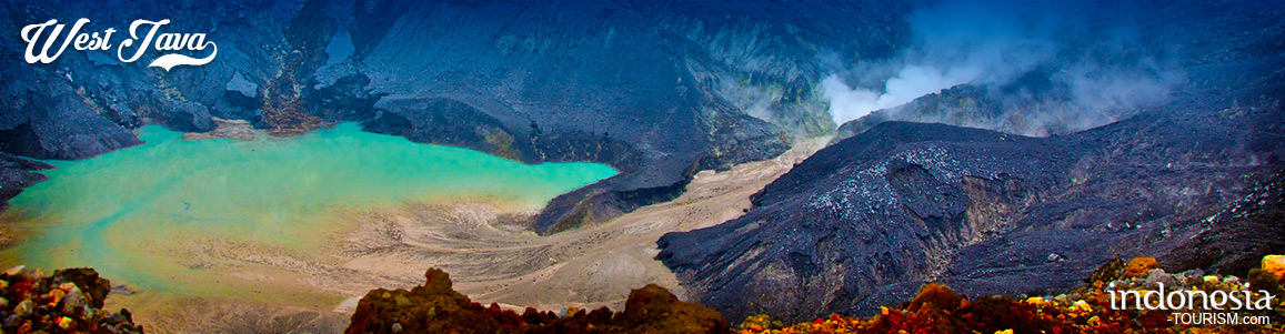
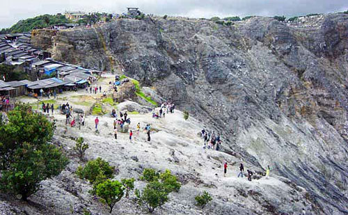
Tangkuban Perahu is a volcano with three craters into which areas tourists can walk through. These three craters are: Kawah Ratu ("Queen Crater"), Kawah Domas ("Domas Crater"), and Kawah Upas ("Upas Crater"). Tourists can go down into the Domas Crater where exist many hot geysers in which they can boil eggs. Though the mountain appears peaceful, mild eruptions occurred in 1969, when Kawah Ratu spewed ash and barrages 500 m high. As recently as September 1992 it was closed to the public for a few days because unusually high seismic activity leads volcanologist to fear a new eruption. On the mountain's northern flank is an area called Death Valley, so named for its frequent accumulation of poisonous gases. On a reasonably clear day, from Kawah Ratu, the main crater, we can see not only the mountain range to the east, with Mt. Bukittunggul as its highest peak (2,209 m), but also two other in a northeasterly direction. Browse Lidl Offers 26 November 2020 on Offers This Week. The lower and nearer one is Mt. Tampomas (1,684 m) just north of Sumedang some 40 km away. To the right and about 90 km away is Mt. Ciremai close to Cirebon on the north coast. At 3,078 m, Mt. Ciremai is West Java's tallest mountain. At the foot of Mt. Tangkuban Perahu we see the Ciater tea plantation covering the rolling hills. Farther to the left are the northern coastal plains of Java, and on an extremely clear day we may even be able to see the Java Sea beyond.
Kawah Ratu, which means "Queen's Crater", is today just a big gray hole, which sometimes has a pool of water at its center. Poisonous gases sometimes accumulate in Kawah Ratu, thus making it somewhat of a risk to descend to the crater floor. Beyond the saddled shaped depression on the far side of Kawah Ratu is the still active Kawah Upas, the oldest crater on the mountain. On the very far western cliff we see a spot where all vegetation has been destroyed by constantly rising sulfurous vapors. On the crater walls, note the various layers of material consisting of rock, sand, and pebbles. Overtime, new craters have formed again and again in a rather consistent shift from west to east. The most well known of these is the Domas crater, but also there are other smaller ones in jungle on the mountain's northeastern flank. Facilities in Tangkuban Perahu Crater are comfortable parking area, souvenir kiosks, and restaurants.

Bogor Botanical Garden Collections
In the Journal of Nature (a scientific journal of high repute), Mounce et al (2017) revealed, widely that Botanical Gardens around the world have collected at least 105,634 species or equivalent to 30% of all known plant diversity worldwide. However, it was also disclosed that there are an estimated 75% of species that have not been conserved in the tropics. Therefore, the Bogor Botanical Gardens which incidentally located in the tropics and are included in the oldest botanical gardens in Southeast Asia, must be able to answer the conservation challenges…
History of Bogor Botanical Gardens
The Bogor Botanical Gardens are the only natural destination in the middle of Bogor city with 87 hectares area. The transportation support capacity is very adequate to access this tourist location. Easy toll access and public transportation access are widely available, which are added values ??for the existence of this tourist location. The existence of the Bogor Botanical Gardens itself cannot be separated from the historical value of the existence of the Dutch in the colonial period, where it is known that the Bogor Botanical Gardens was founded by the…
Ranca Upas, Camping Place in Bandung
Ranca Upas is one of the tourist destinations in Bandung. Here you can camp while looking at the herd of deer and stunning scenery. Ranca Upas is a tourist spot located in Rancabali District, Bandung Regency, West Java. Ranca Upas is also known as campground, which is a favorite place for nature lovers. At Ranca Upas you can camp in the meadow on a hill of about 1700 meters above sea level. The view in the morning really amazes like being abroad. Moreover, the cool air makes the atmosphere more…
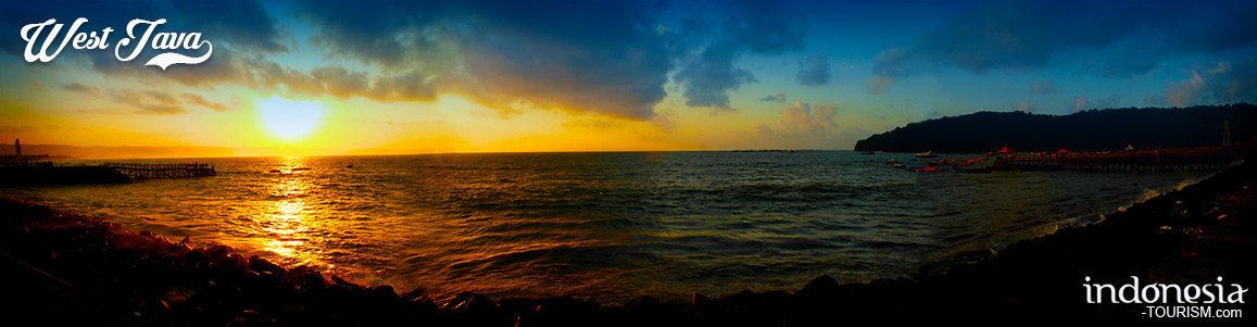
3 Most Popular Waterfalls in West Java
Last year, the waterfall or in local language called as ‘curug’, became a very popular tourist destination for tourists. Its presence in remote areas makes tourists more curious and feels challenged to reach it. Local waterfalls are also crowded because at that time Indonesian citizens were hit by boredom due to the Corona virus pandemic which forced them to cancel their vacation plans. West Java is not only famous for its beautiful beaches and mountains. The area, which is divided into 18 districts and nine cities, also has tourism potential…